Mount Shasta
One Saturday in January, while still living in northern California, we got another calling to visit more mountains. We decided to do a quick day trip from Clearlake, so our exploration of Mt. Shasta and Lassen Volcanic National Park was by no means all encompassing, but we were able to get a general idea for what these places are all about!
We hopped on I-5 North and soon saw the beastly Mt. Shasta on the horizon. We kept thinking we were getting close, but the drive up to Castle Lake, which lies to the west of Shasta, took about three hours. We parked by Castle Lake because we were told we could find the Heart Lake Trail from here and that it had beautiful views at the end. Castle Lake is a pretty and very accessible alpine lake, but Heart Lake proved to be much more difficult to find.
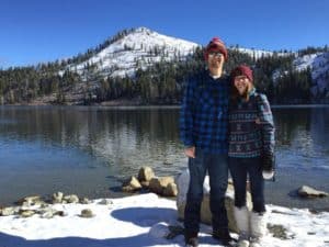
Castle Lake
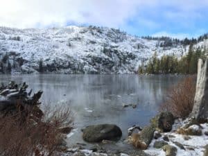
Another shot of Castle Lake in Mount Shasta Recreation Area.
Castle Lake
Another shot of Castle Lake in Mount Shasta Recreation Area.
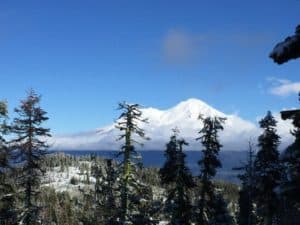
Because we were hiking in the winter, it was not very busy, the nearby campground was closed, and things were not well-marked. There were a few other people also unsuccessfully searching for the start of Heart Lake Trail in this area. This would usually be a situation where we utilize the AllTrails app to help us find our way, but we had lost service long before, and this was before we knew we could download the trail maps ahead of time (in other words, we were unprepared, ha-ha). We did come prepared with our snow gear though, so the three of us – Megan, Adam, and Nyssa (one of our favorite exploring buddies) decided to off-trail it in the direction of Heart Lake hoping to run into the trail at some point. We knew it was south on our way for Heart Lake, so we started off in that direction, which ended up being almost straight up a mountain. We used tree branches to hold ourselves upright as our boots were sinking into knee deep snow. Our hearts were working hard as we scaled this mountain, so we stopped a couple times to enjoy the view of Mt. Shasta, Black Butte, and a new bird’s eye view of Castle Lake. Our plan was to reach the summit of this mini mountain in hopes of setting our eyes on Heart Lake. Just as we were approaching the summit, Nyssa stopped in her tracks and nervously mentioned she saw a huge paw print in the snow in front of her. We then looked around and noticed these huge paw prints all over the place. We must have been getting dangerously close to a mountain lion’s den, so we very quickly started running/sliding/rolling down the mountain we had just worked so hard to climb. Once we made it back down to Castle Lake, our heart rates finally slowed, and we decided as a group that this would not be the day we find Heart Lake.
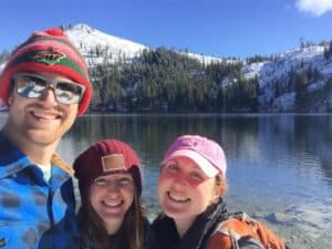
Exploring with one of our favorite hiking buddies, Nyssa.
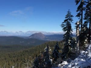
Black Butte: the largest of Mount Shasta’s satellite volcanic peaks
Exploring with one of our favorite hiking buddies, Nyssa.
Black Butte: the largest of Mount Shasta’s satellite volcanic peaks
The real Heart Lake Trail is a 3-mile hike with 1,200 ft elevation that is supposed to be accessible year-round. We still aren’t quite sure where we went wrong in finding the trailhead, so learn from us and be sure to do your research and download maps ahead of time! From what we’ve heard, Heart Lake is a cool destination due to the beautiful view you get of Mt. Shasta and its reflection in the lake. Of course, we wouldn’t have gotten the reflection view in the winter time anyways, so we’ll just have to return in the summer sometime! That being said, we were still able to get some great views of Mt. Shasta from the Castle Lake area.
Mount Shasta – 14,180 ft
Lassen Volcanic National Park
Lassen Volcanic Nat'l Park
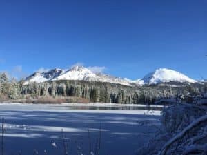
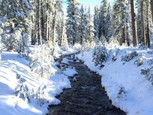
From the Castle Lake area, we took the scenic highway 89 south for about 1.5 hours to Lassen Volcanic National Park. Like the Castle Lake grounds, mostly everything was shut down for the winter, and so we were only able to make it less than a mile into the park. We chose to park near Manzanita Lake where we did some flat hikes in the fresh snow. Manzanita Lake Trail is about 1.5 miles and Reflection Lake Trail is about 0.5 miles. Both are loop trails. After trekking through the shin-deep snow of these two trails, we wandered off deeper into this winter wonderland until we thought we might get lost, so we followed our tracks back. You get some very nice views of the Mount Lassen volcano from this Manzanita Lake area.
Manzanita Lake Loop
A winter wonderland!
Manzanita Lake Loop
A winter wonderland!
Sierra Nevada Brewing Company
Sierra Nevada Brewing Co.
Of course, we had to end our day of winter hiking with some craft beer. From Manzanita, we drove south about another two hours to Chico where you can find the well-known Sierra Nevada Brewing Company. The building here is quite impressive, including a restaurant, taproom, and the brewery itself. Unfortunately, we just missed the free tour by the time we arrived for dinner. They offer a complimentary 45-minute Brewhouse tour. They also offer some other longer/more detailed tours that you can pay for. Regardless, we had a great experience here. Both the beer and the food were just what we needed after a hiking-filled day!
Wow! Some of what you did sounds really dangerous – mountain lions, sliding back down a mountain. Bet both of your mothers are happy they didn’t know about it until you were safe again!